September 4, 2013

Mt Sneffels


On the last day of the San Juans trip we headed up to Yankee Boy Basin to climb Mt Sneffels via the SW ridge route. Andrea and I did this climb three years ago, and since Amiee had never been on the summit of a 14,000 foot peak, we thought this would be a fun debut for her.

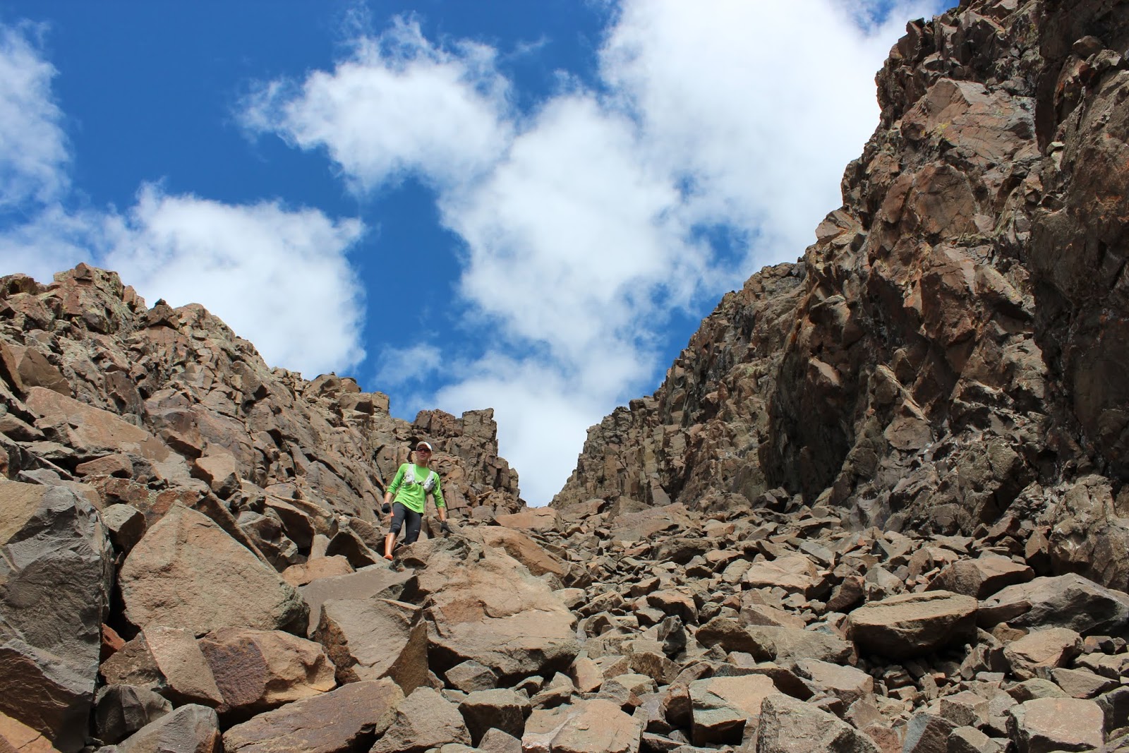
The SW ridge (from the low point on the left side of the above photo, through the pinnacles to the summit) has some fun scrambling. We took that route for the ascent, and then descended via the standard route (giant scree field on the right). 


Highland Mary Lakes Loop


Wow. One of the best hikes we've ever done. Mile for mile, the scenery and views were unparalleled.

The Highland Mary Lakes loops starts down a dirt road a little east of Silverton. After climbing up through the tundra and past some lakes, you reach a viewpoint above Verde Lakes (above) with spectacular views of the Grenadier Range.

It was really a special treat to share this one with a great group of friends.

Photo explosion time!...


Ice Lakes


Have you ever seen a lake THIS blue? No, it's not filled with anti-freeze or toiler bowl cleaner... according to 5280 magazine, here is the reason for the color:

Upper Ice Lake is a glacial tarn—a lake carved and fed by glaciers—that gets its near-fluorescent blue color from rock flour. When a glacier moves, it grinds the bedrock below, creating a crushed-rock powder that suspends in the water and absorbs the sun’s light spectrum in a way that creates a beautiful cerulean appearance. There are only a handful of similarly colored glacial lakes in the state.

Pretty spectacular. And what made this hike even more special is that after spending the first couple days of the San Juans trip solo, the adventure team reinforcements showed up last night - Andrea and our friends Amiee, Allie, and James. They all drove down from SLC to meet me for a few days of fun in the mountains.

More photos from Ice Lakes...


August 29, 2013

Gray Copper to Corkscrew Gulch from Ironton

Dirt with so much iron that eating it cures anemia on the spot!
I wasn't sure where to hike today (but you can't really go wrong anywhere in the San Juans), and wanted to check out the Ironton ghost town, so I figured I could link together a hiking trail and some jeep roads in that area and create a small loop. 

I parked right off highway 550 and started from there... went up Gray Copper Gulch to the Vernon mine, then connected with the jeeps roads that wrap around the backside of Red Mountain #1, and back down Corkscrew Gulch. According to the GPS, it was 9 miles, but that's probably an overestimation. Total elevation gain was probably a little under 3000 feet. 

A pretty nice loop and other than a few jeepers, I didn't see a single person out there.

Cool RZR
I didn't eat this
Gray Copper Gulch

Cement Creek basin and the road heading towards Hurricane Pass
Silverton Mountain Ski Area

Corkscrew Gulch and the other Red Mountains
The approximate route with help from our friends at Microsoft Paint